|
We are plunged into the sense of isolation again. The deep blue Tongue is an abyssal fissure below. At the very edge of its underwater cliffs 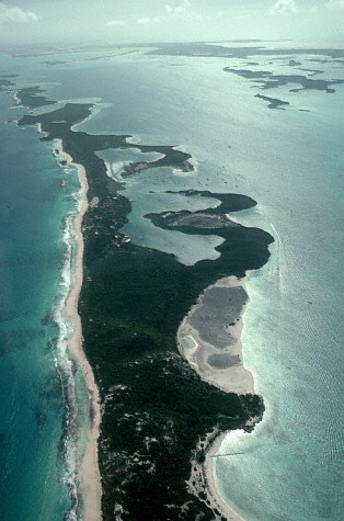 lazy white squiggles in dazzling thin aquamarine waters mark a long broken chain of islands. lazy white squiggles in dazzling thin aquamarine waters mark a long broken chain of islands.
The Exuma Islands are a long chain of cays really, and most aren’t islands in any sense of the word. They stretch southeast from Nassau and are green mottled blobs basking in the bright glassy waters of the shallows. They are dangerously close to that mysterious Tongue of the Ocean, standing on its precipice and forever gazing out at that blue swath
in the azure waters.
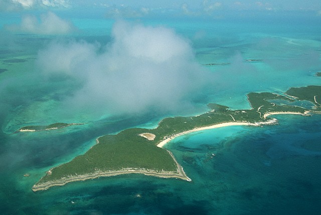
The Exumas are sparsely populated, though they are situated in a way that places them under heavy air travel and as a halfway point for yachts. Again, like the other Bahama islands, it would be wrong to imagine these as beautiful palm lined paradises. Low bushes, casuarina trees and “sea oats” make up the greenery. Also, countless cays are small, some tiny, others only a barrier reef just above the water level.
The most populated is Great Exuma, the largest and most southernmost, with the settlement of Georgetown. Staniel Cay is a common halfway point in this outback chain. Nearby here and Big Major Cay is “Thunderball Cave,” a natural grotto for divers and snorkelers which some consider more beautiful than Amalfi on the coast of Italy by Capri. However, Thunderball Cave is far more remote, and its natural beauty gains more luster from its wilderness isolation.
 |
|
A typical cay in the Exumas
|
|
There are settlements on these cays, like Hurricane Harbour, but not many. Some have runways good only during the day (since they have no lights). One thing they all have. Each has one or more turquoise bay with mottled bottoms of turtle grass. Boats dot the shimmering crescents; some can be seen peacefully dazzled in sunlight reflections at deserted cays. Many yachters use these 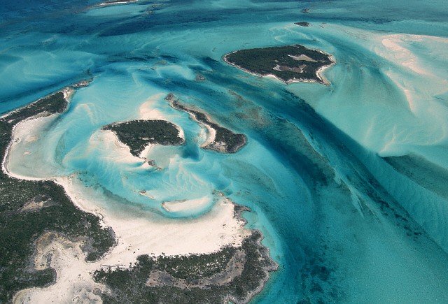 as a halfway mark to and from the Caribbean. as a halfway mark to and from the Caribbean.
The dangerous currents and shifting sands of the Great Bahama Bank are clearly seen around the Exumas. At low tide much of the sandy bottom around some cays can become land. Exotic patters in the sand show how strong the scouring current can be. Channels that look like a beautiful blue lagoon can have treacherous undercurrents, especially when the tide shifts. These create such marvelous patters as those 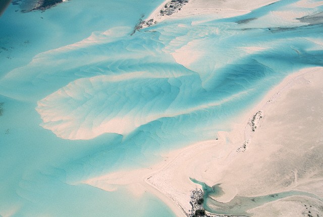 below. View of nature at work along here is most often only from an airplane. If you take a boat from a nearby populated cay, you often can’t come in close to such scenery due to the shifting bottom. below. View of nature at work along here is most often only from an airplane. If you take a boat from a nearby populated cay, you often can’t come in close to such scenery due to the shifting bottom.
Sometimes even far out, with no land in sight, yachters can come upon “sand bores,” parallel ridges of sand scoured into a frustrating maze with clear deep channels between these underwater sand dunes. They shift with the tide and cannot be marked.
Evening and morning cause other things to come to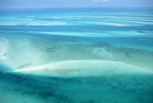 life on these quiet cays. The temperature at this time of ember-like dusk is perfect, the breeze lulls one to peaceful sighs. A patter, a scurry, rustling in undergrowth, scampering— and dozens of iguanas emerge onto the beaches and head for the tide line. A large central cay received its name from their population: “Great Guana Cay.” life on these quiet cays. The temperature at this time of ember-like dusk is perfect, the breeze lulls one to peaceful sighs. A patter, a scurry, rustling in undergrowth, scampering— and dozens of iguanas emerge onto the beaches and head for the tide line. A large central cay received its name from their population: “Great Guana Cay.”
A bit of nothing in nowhere, below. All day long the wind does nothing but curse over this petty obstacle  and the sea hammers away at it relentlessly. At night it’s cold, during the day it’s hot. No shadow, no relief. Bad place to be shipwrecked. This could be 50 miles from Nassau, but any place outside the view of others can be hazardous in the Bahamas. and the sea hammers away at it relentlessly. At night it’s cold, during the day it’s hot. No shadow, no relief. Bad place to be shipwrecked. This could be 50 miles from Nassau, but any place outside the view of others can be hazardous in the Bahamas.
Those mottled waters contain many dangers to boaters and swimmers. The currents are swift, treacherous, and their native inhabitants can strike quickly. Reef sharks and barracudas have claimed this as their domain long before Columbus.
|